
INTRODUCTION
In this topic, we are going to show you how to build a landform model for your science project or exhibitions.
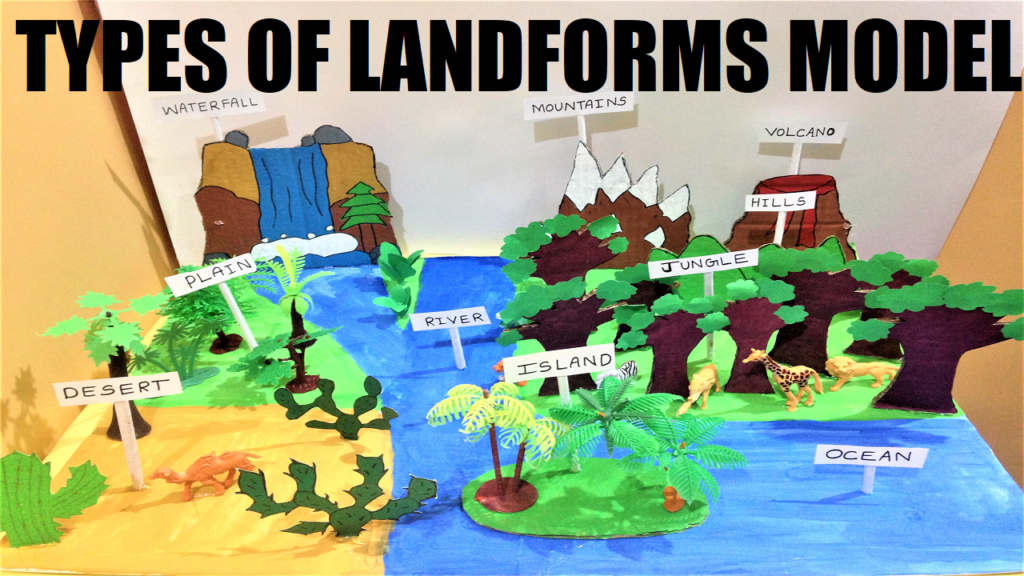
The landform is a natural feature of the earth’s surface. Topography means landforms made up the terrain and their arrangement in the landscape.
Landforms are made up of canyons, plateaus, valleys, mountains, hills and shoreline such as bays, peninsulas, and seas which includes submerged features such as mid-ocean ridges, volcanoes, and ocean basins.
Landforms are characterized by physical characteristics such as slope, elevation, rock exposure, stratification, orientation and finally soil type.
It includes elements such as hills, ridges, berms, mounds, cliffs, rivers, valleys, volcanoes, and peninsulas, numerous other structural and size-scaled (i.e. ponds Vs. Lakes, hills Vs. mountains) elements.
Oceans and continents form the highest order landforms. Landform elements can be further identified and given cohesive definition such as hill-tops, shoulders, saddles, for slopes and back slopes.
Generic landform elements are: peaks, channels, ridges, pits, passes, pools and plains.
Terrain is the third dimension of the land surface. Study of the terrain is called as Topography.
When relief is underwater it is termed as bathymetry. Many different techniques used to describe relief in cartography are contour lines and triangulated irregular network.
Smallest homogeneous divisions of the land surface are elementary landforms (segments, facets, relief units).
These areas contain homogeneous morphometric properties, bounded by lines of discontinuity.
How to make An Landform Model Step by Step Video
In this video, we will show you the following steps and items that can be used to build a landform model at home by taking help freely from your parents.
Materials Used to make Landform – DIY
- White Chart Paper
- Color Paints
- Card Board
- Sketch Pens
- Pencil
- Paintbrush
- Plastic trees and animals
- Fevicol
- Hot Glue Gun
- Waste Boxes to get cardboard
- Scissor to Cut
Prepare for Science Fair Questions & Answers – Landforms Model
- What are the most common landforms?
Most common landforms are vast oceans, plains, high mountains, plateaus, and hills. - What are the types of landforms?
Types of landforms on earth are mountains, valleys, plateaus, glaciers, hills, loess, plains and desserts functionality of garbage disposal. - What are the 8 landforms?
8 landforms are Mountains, hills, plateaus, plains, buttes, canyons, valleys, and basins. - What are the types of land we have?
Types of lands are: recreational, transport, agricultural, residential, and commercial. - What are some patterns in landforms on Earth?
Different patterns of landforms are mountains, plateaus, shields, valleys, and plains.
Conclusions
Landform helps us to understand various features of the earth surface that are formed naturally. Major landforms like mountains, plateaus, and plains are used to learn the geographical nature of various regions.