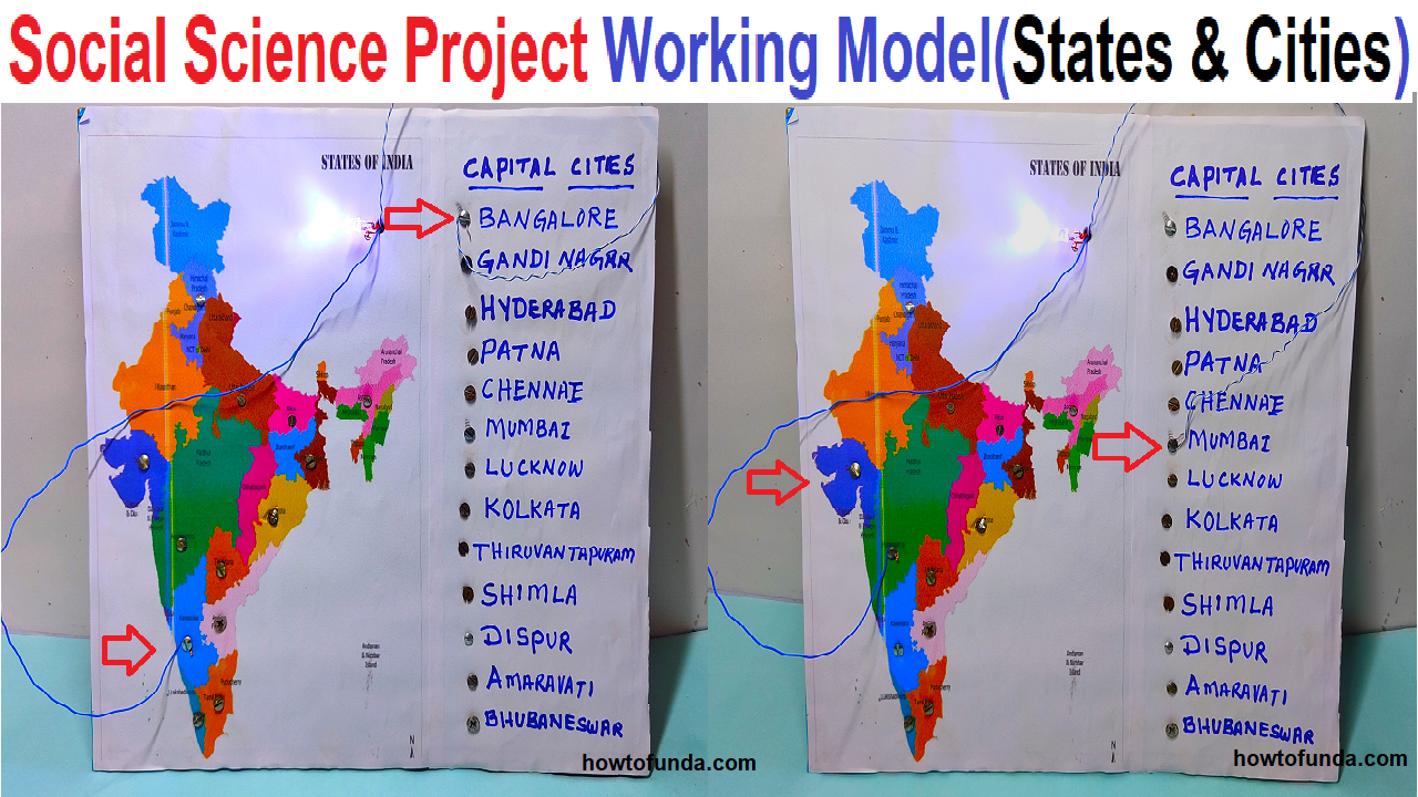
An Indian states and capital working model is a project or educational tool that represents the different states and their corresponding capitals of India.
India is divided into 28 states and 9 union territories. The states and their respective capital cities are:
- Andhra Pradesh – Amaravathi
- Arunachal Pradesh – Itanagar
- Assam – Dispur
- Bihar – Patna
- Chhattisgarh – Raipur
- Goa – Panaji
- Gujarat – Gandhinagar
- Haryana – Chandigarh
- Himachal Pradesh – Shimla
- Jharkhand – Ranchi
- Karnataka – Bengaluru
- Kerala – Thiruvananthapuram
- Madhya Pradesh – Bhopal
- Maharashtra – Mumbai
- Manipur – Imphal
- Meghalaya – Shillong
- Mizoram – Aizawl
- Nagaland – Kohima
- Odisha – Bhubaneswar
- Punjab – Chandigarh
- Rajasthan – Jaipur
- Sikkim – Gangtok
- Tamil Nadu – Chennai
- Telangana – Hyderabad
- Tripura – Agartala
- Uttar Pradesh – Lucknow
- Uttarakhand – Dehradun
- West Bengal – Kolkata
Union Territories and their respective capital cities are:
- Andaman and Nicobar Islands – Port Blair
- Chandigarh – Chandigarh
- Dadra and Nagar Haveli and Daman and Diu – Silvassa
- Lakshadweep – Kavaratti
- Delhi – New Delhi
- Puducherry – Puducherry
- Lakshadweep – Kavaratti
- Chandigarh – Chandigarh
- Daman and Diu – Daman
It can be made using a variety of materials such as paper, cardboard, wood, or plastic.
The model typically includes the map of India with all the states and union territories, and the capital cities are marked on the map with labels.
This model can help students learn about the geography and political divisions of India, and also help them to memorize the states and their capitals.
The Indian states and capital working model can be made using different methods, some examples of which are:
- Using a physical map of India and marking the states and capitals with different colors, labels or pins.
- Creating a digital map of India on a computer and marking the states and capitals on it.
- Making a 3-Dimensional model of India using materials like clay, paper mache or thermocol and marking the states and capitals on it.
The Indian states and capital working model can be a fun and interactive way for students to learn about the geography of India, and also for anyone who wants to learn about the states and their capitals. This can be also used as a tool for general knowledge or quizzes
#socialscienceproject #workingmodel #indiastates #indiastatecapitals #sst #diy #howtofunda #sciencefair #scienceexhibition #scienceproject
