Concept / Principle:
A geostationary satellite is a satellite that orbits the Earth once every 24 hours — the same time the Earth takes to rotate once on its axis.
Because both rotate at the same rate in the same direction, the satellite appears stationary above one fixed point on Earth (like over India or the equator).
This concept is used in telecommunication, weather monitoring, and GPS systems.
Scientific Explanation:
- The Earth rotates from west to east (counterclockwise when viewed from above the North Pole).
- The satellite revolves around the Earth in the same direction, at a specific altitude of about 35,786 km above the equator.
- The satellite’s angular speed = Earth’s rotational angular speed → making it appear fixed to an observer on Earth.
Materials Required:
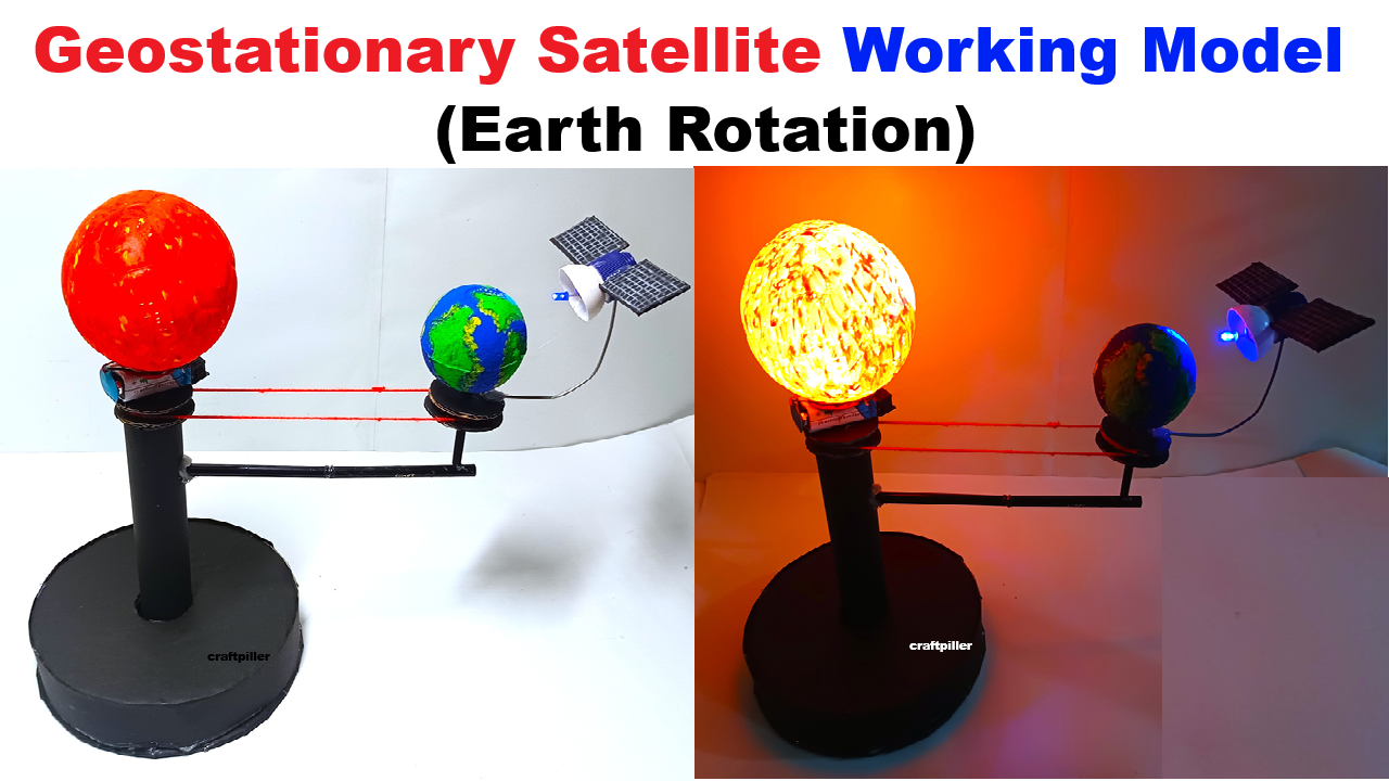
- Thermocol ball (Earth) – medium size
- Small plastic ball / ping pong ball (Satellite)
- Skewer stick / thin iron wire / stiff straw (for orbit arm)
- DC motor or hand-rotating handle (for Earth rotation)
- Cardboard base
- Battery, switch, connecting wires (optional motor)
- Paints / colored paper (blue, green for Earth)
- Glue gun or Fevicol
- Markers for continents and equator
- LED light (optional – to show satellite signal)
Step-by-Step Model Making:
Step 1 – Make the Earth
- Take a thermocol ball and paint it blue and green to represent oceans and continents.
- Draw the equator clearly using a black marker.
- Fix the Earth ball onto a skewer stick or small stand (vertical rod) attached to a cardboard base — so it can rotate.
Step 2 – Add Rotation (Earth’s Spin)
Option 1️⃣ (Manual):
- Use a handle made from a stick or straw to rotate the Earth manually.
Option 2️⃣ (Motorized):
- Fix a small DC motor under the base.
- Connect the motor shaft to the Earth’s axis using a thin rod.
- Connect to a 9V battery + switch to make it rotate slowly.
Step 3 – Attach the Satellite
- Fix a bent wire / straw / stiff plastic arm to the top of the base near the Earth’s equator.
- Attach the small ping pong ball (satellite) at the other end of the wire.
- The arm should allow the satellite to revolve around the Earth when Earth rotates.
Step 4 – Set the Satellite Position (Geostationary)
- Adjust the wire so the satellite moves with the Earth’s rotation but stays above one fixed point on the equator (this shows geostationary orbit).
- Optionally, add a small LED on the satellite connected via thin wires to show it’s “active.”
Step 5 – Decorate and Label
- Decorate the base with black or blue chart paper to represent space.
- Add small stars or planets for effect.
- Label parts:
- Earth
- Satellite
- Orbit Path
- Direction of Earth’s Rotation
- “Geostationary Orbit (35,786 km above Equator)”
Explanation (For Presentation):
“This working model demonstrates a Geostationary Satellite. As the Earth rotates on its axis, the satellite also revolves around Earth in the same direction and speed. Hence, it stays fixed above one point on the equator. This principle is used in TV broadcasting, weather satellites, and GPS communication.”